Marine Recreational Information Program
The Marine Recreational Information Program (MRIP) is a state-regional-federal partnership that collects data about how often anglers fish and what they catch.

NOAA Fisheries’ Marine Recreational Information Program is the state-regional-federal partnership that develops, improves, and implements a national network of surveys to measure how many fish anglers catch and how many trips they take. The data we collect help scientists and managers assess and maintain sustainable fish stocks.
The Marine Recreational Information Program operates as a partnership. NOAA Fisheries maintains a central role in developing survey and estimation methods, administering recreational fishing surveys, and producing estimates of recreational catch. Regional and state partners identify information needs, coordinate survey operations and on-site data collection, and participate in quality assurance and quality control procedures.
NOAA Fisheries is committed to using the best available science to produce its recreational catch estimates. Our survey and data standards help ensure the integrity of our data collection efforts and the quality of our recreational fisheries statistics. Ongoing research improves data collection across the United States. And quality assurance and quality control procedures minimize the potential for errors in the information we publish.
NOAA Fisheries provides open access to its recreational fishing data. Use the MRIP Query Tool to filter data by time series, geographic area, species, mode, and other characteristics, or visit the Recreational Fishing Data Downloads page to access our public-use datasets and statistical analysis programs. Subscribe to our email service to be notified of data updates.
The Modernizing Recreational Fisheries Management Act of 2018 requires NOAA Fisheries to report on certain aspects of the Marine Recreational Information Program’s work. As of January 2021, the agency has submitted a report on its incorporation of recreational fishing data from state agencies and non-governmental sources. Reports on our plans to enhance existing state data collection partnerships and continue our progress toward the recommendations of a 2017 National Academies of Sciences review are under development.
In 2018, anglers in Hawaii and along the Atlantic and Gulf coasts took almost 185 million saltwater fishing trips. Two-thirds of those trips took place from shore.
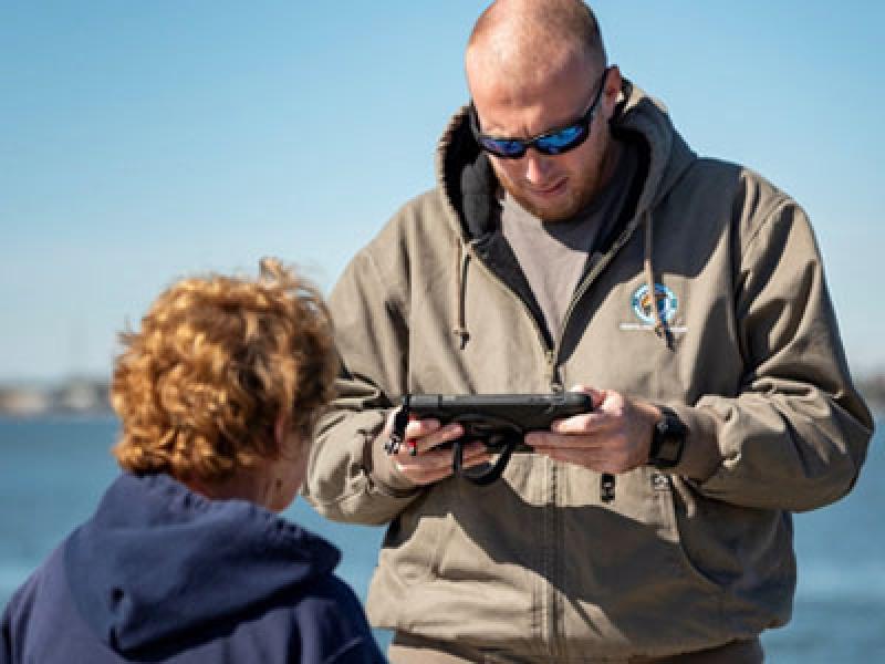
Our partners interview anglers at thousands of marinas, boat ramps, beaches, and other publicly accessible fishing sites across 16 coastal states.
The Access Point Angler Intercept Survey, Fishing Effort Survey, and For-Hire Survey collect data on all of the species anglers catch.
In Louisiana, Mississippi, Alabama, and Florida, alternative general and specialized surveys help us produce more precise estimates of recreational catch.
In-person interviews, telephone and mail surveys, and electronic reporting are methods we use to collect information from private anglers and for-hire operators. While we could never collect data from all saltwater anglers, surveying a representative sample allows us to estimate catch and effort for the entire marine recreational fishing population.
The calculations we use to produce catch estimates can be understood as expanding catch rate, or the estimated number of fish caught per angler trip, by effort, or the estimated number of fishing trips taken in a two-month period.
Our searchable database of catch, effort, and fishing participation statistics allows users to filter our data by time series, geographic area, species, mode, and other characteristics.
Our searchable database of marinas, boat ramps, beaches, and other publicly accessible fishing sites on the Atlantic and Gulf coasts includes information about site usage and amenities, and helps us determine where we should conduct in-person angler interviews.
The Marine Recreational Information Program (MRIP) is a state-regional-federal partnership that collects data about how often anglers fish and what they catch.
NOAA Fisheries’ Marine Recreational Information Program works with state and regional partners to implement a national network of recreational fishing surveys. We use data collected from anglers and for-hire operators to estimate the number of fish anglers catch and the number of trips they take. These recreational catch and effort estimates help scientists and managers assess and maintain sustainable fish stocks.
From in-person interviews to electronic reporting, different methods of data collection help us gather information from anglers and for-hire operators.
Learn how we sample the recreational fishing community
Unique regions have unique fisheries, fishing communities, and preferred methods of collecting recreational fishing data. For this reason, our methods of data collection are regionally specific. We administer general surveys, which provide annual catch estimates for all species encountered, and specialized surveys, which collect data for select fisheries or during select fishing seasons. Pairing general surveys—such as the Access Point Angler Intercept Survey, Fishing Effort Survey, and For-Hire Survey—with specialized surveys—such as the Large Pelagics Survey—allows us to develop more comprehensive recreational catch estimates.
NOAA Fisheries’ Marine Recreational Information Program provides open access to the information needed to understand the recreational fishing data that inform science and management decisions and the way these data were produced.
The exact number and species of finfish caught by marine recreational anglers is impossible to determine, because one complete marine recreational fishing census is impossible to administer or verify. But we can be confident in our recreational catch estimates because they are derived from sound survey methods that have been developed, tested, and independently reviewed by experts in statistical survey design. Sampling populations, weighting sampled units, and accounting for errors, outliers, and uncertainty are important steps in our work to estimate recreational catch.
Learn the fundamentals of survey statistics
At its core, estimating total recreational catch involves multiplying catch rate, or the average number of fish caught per angler trip, by effort, or the total number of fishing trips taken. But each step of our estimation process also involves statistical weighting, which ensures important aspects of our sample design—like the fact that some fishing sites are more likely to be selected as a sample location or some anglers are more likely to participate in a fishing survey—are correctly reflected in our final estimates.
Learn the fundamentals of weighted estimation
Stock assessors and fisheries managers base their work on continuous, uninterrupted time series of fisheries statistics. The implementation of new recreational fishing surveys or the modification of existing survey designs can disrupt this time series, producing new estimates that aren't directly comparable to legacy estimates. Calibration is a statistical process that accounts for the sources of variation that can drive the differences between two data sets. While there is no "one size fits all" calibration method, the purpose of calibration is always the same: to allow estimates from one survey design to be expressed in the units, or "currency," of another.
Learn how NOAA Fisheries has used calibration to transition to new survey designs
NOAA Fisheries’ Marine Recreational Information Program provides open access to the data collected by its recreational fishing surveys and the calculated statistical values produced from this information.
There are several ways to access our recreational fishing data. You can use the MRIP Query Tool to filter data by time series, geographic area, species, mode, and other characteristics, or download public-use datasets and perform your own custom analyses.
Learn about data availability, data review, and data use considerations
Our recreational catch estimates are combined with commercial catch data, biological research, and information gathered from direct observations of fisheries to help scientists assess fish stocks. Stock assessments produce reports that help fisheries managers set rules and regulations to protect the sustainability of stocks now and for generations to come.
NOAA Fisheries’ Marine Recreational Information Program is committed to using the best available science to produce its recreational fisheries statistics.
To ensure our fisheries statistics are derived from scientifically sound methods, we’ve established a comprehensive and collaborative survey design certification process. To earn certification, survey designs and estimation methods must meet a shared set of standards and undergo peer review. For new surveys to inform stock assessments, survey sponsors must work with the MRIP Transition Team to describe how historical estimates will be placed into the “currency” of new or improved certified survey designs.
Learn about our certification and transition policies and procedures
To promote data quality, consistency, and comparability across our recreational fishing surveys, we’ve established seven Survey and Data Standards. These standards reflect best practices currently in place at the National Center for Health Statistics, U.S. Census Bureau, and other federal agencies, as well as statistical survey standards and guidelines published by the Office of Management and Budget. Ultimately, the standards will further ensure the integrity of our data collection efforts, the quality of our recreational fisheries statistics, and the strength of science-based management decisions.
Learn about our survey and data standards
Funding and conducting research to review and improve recreational fishing data collection allows us to keep pace with emerging science and information needs while producing the high-quality data that support science and management.
The Catch Sharing Plan authorizes transfers of Alaska commercial halibut individual fishing quota …
Fisheries Economics of the United States (FEUS) is an annual report that provides economic…
This report to Congress describes the Marine Recreational Information Program's progress toward the…
This document explains how NOAA Fisheries will establish the state-federal recreational data…
Summary of ocean ecosystem indicators used to characterize juvenile marine salmon survival in the Northern California Current.
This fact sheet explains the differences between new and legacy estimates of recreational saltwater…
This rack card explains how the Marine Recreational Information Program uses angler information…
This fact sheet describes the Marine Recreational Information Program's work to develop and certify…