Displays spatial data for marine and anadromous species listed under the Endangered Species Act (ESA) in the West Coast Region. The core datasets are ESA-listed species’ ranges and critical habitat.
Maps and Geographic Information Systems (GIS) data for fisheries management, critical habitat, and habitat conservation including essential fish habitat in the southeast United States, including the U.S. Caribbean.
Partners from state, federal, non-profit, and private organizations that work together on the ShoreZone mapping system to map the shoreline of Alaska, Oregon, Washington and British Columbia.
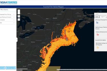
The EFH Mapper is an interactive tool for viewing important habitats for managed fish species. We provide links to supporting materials, including fishery management plans, and the ability to download GIS data.
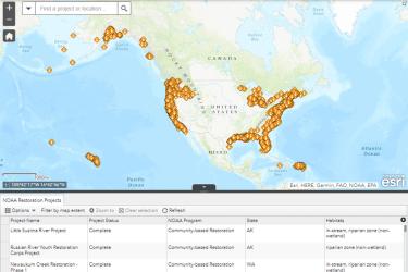
The interactive Restoration Atlas will help you find habitat restoration projects near you—search for projects by habitat type, location, or congressional district.
Scientists with NOAA’s National Ocean Service recently completed an 11-day mission to map undersea habitats in the Caribbean, including coral habitats used by valuable species of reef fish.