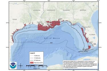
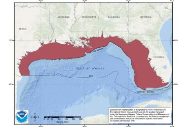
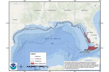
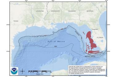
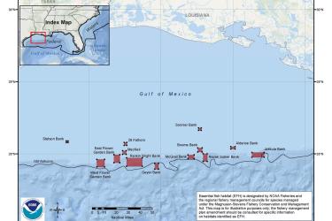
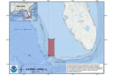
Maps and Geographic Information Systems (GIS) data for fisheries management, critical habitat, and habitat conservation including essential fish habitat in the southeast United States, including the U.S. Caribbean.
The bathymetry of the Aleutian Islands is poorly described and relatively unknown, considering that it and the rest of Alaska have been part of the United States since 1867.