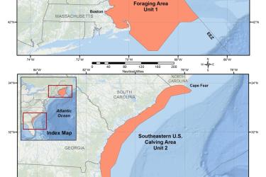
Map and GIS data representing critical habitat for the conservation of endangered North Atlantic right whale in the Greater Atlantic and Southeast Regions.
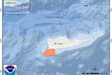
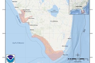
Maps and Geographic Information Systems (GIS) data for fisheries management, critical habitat, and habitat conservation including essential fish habitat in the southeast United States, including the U.S. Caribbean.
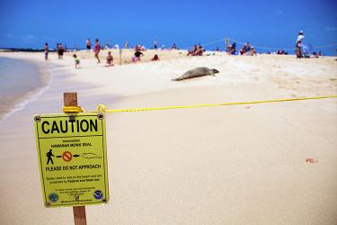
This video will enhance public understanding of human-seal interactions and the direct impact that has on the population and recovery of the monk seal species.
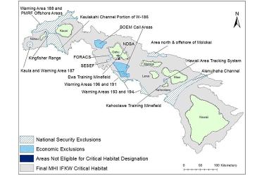
Map and GIS data representing critical habitat for the main Hawaiian Islands insular false killer whales in waters from 45 meters to 3,200 meters (49 to 3,500 yards) in depth surrounding the main Hawaiian Islands (from Ni‘ihau to Hawai‘i Island).
The Endangered Species Act (ESA) requires that, to the maximum extent prudent and determinable, critical habitat be designated for endangered and threatened species based on the best scientific data available. This report contains a biological assessment
This report contains the National Marine Fisheries Service (NMFS), Pacific Islands Regional Office (PIRO) recommendations for critical habitat under section 4 of the Endangered Species Act (ESA), for the main Hawaiian Islands (MHI) insular false killer wh
This Final Economic Report identifies and analyzes the potential economic impacts resulting from critical habitat designation for the Main Hawaiian Islands (MHI) insular false killer whales (IFKW) (Pseudorca crassidens) distinct population segment (DPS).