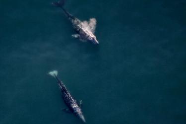
This report describes field activities of the Aerial Surveys of Arctic Marine Mammals (ASAMM) project conducted during summer and fall (1 July–31 October) 2016, and data and analyses used to summarize field activities. Surveys were based in Barrow, Alaska, and Deadhorse, Alaska, and targeted the northeastern and southcentral Chukchi and western Beaufort seas, between 67°N and 72N latitude and 140°W and 169°W longitude. Between 19 July and 20 August, surveys extended up to 111 km north of the usual ASAMM study area to collect information specific to the Eastern Chukchi Sea (ECS) stock of belugas.