About the Marine National Monuments
There are four Marine National Monuments within the Pacific Islands region: The Papahānaumokuākea Marine National Monument, which was established in June 2006 by Presidential Proclamation 8031; and the Marianas Trench, Pacific Remote Islands, and Rose Atoll Marine National Monuments, which were established in January 2009 by Proclamations 8335, 8336, and 8337, respectively. The Pacific Remote Islands and Papahānaumokuākea monuments were expanded in September 2014 by Proclamation 9173 and August 2016 by Proclamation 9478, respectively.
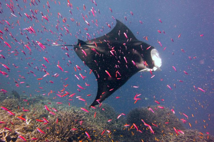
The Monuments were created to protect the respective areas' abundant and diverse coral, fish, and seabird populations; facilitate exploration and scientific research; and promote public education regarding the value of these national treasures.
The establishment of the Monuments provides the opportunity to protect areas of outstanding resource biodiversity and scientific, cultural, and aesthetic value, and provide for the long-term persistence of these natural and cultural legacies. By designating these areas of the Pacific Ocean as Marine National Monuments, the United States ensures that the marine environments receive the highest level of environmental recognition and conservation.
NOAA Fisheries, in cooperation with various partnering agencies, coordinates the development of management plans, scientific exploration, and research programs within the Marine National Monuments in the Pacific Islands region.
Under NOAA's existing authorities and the Antiquities Act of 1906 (which authorizes the U.S. President to reserve lands and waters of the nation as National Monuments), the Marine National Monument Program works with federal and regional partners and stakeholders to conserve and protect the marine resources in these large marine protected areas.
Management

NOAA's Marine National Monument Program co-manages the three Pacific Marine National Monuments created by Presidential Proclamations in 2009, as well as the Papahānaumokuākea Marine National Monument in the Northwestern Hawaiian Islands. The three 2009 Monuments encompass a total area of 600,684 square miles (1,555,764 square kilometers) and include the Marianas Trench, Pacific Remote Islands, and Rose Atoll Marine National Monuments.
With the expanded Papahānaumokuākea Monument, the total area for the U.S. Marine National Monuments in the Pacific is 1,182,717 square miles (3,063,223 square kilometers).
NOAA and the U.S. Fish and Wildlife Service—in cooperation with the Commonwealth of the Northern Mariana Islands and American Samoa governments for the Marianas Trench and Rose Atoll Monuments, respectively—maintain management responsibility for the Marine National Monuments.
The Monument managers are developing management plans for these magnificent marine protected areas to guide their continued protection.
Science

Monument, Sanctuary, or Marine Protected Area?
A marine protected area, or MPA, is a general term describing an area of the marine environment with some level of protection. Executive Order 13158 defines an MPA as:
"...any area of the marine environment that has been reserved by federal, state, territorial, tribal, or local laws or regulations to provide lasting protection for part or all of the natural and cultural resources therein."
The main difference between MPAs, National Marine Sanctuaries, and Marine National Monuments is the designation process and the laws under which they're established:
- MPAs are designated through local, state, or federal authorities in response to proposals.
- Sanctuaries are designated through the National Marine Sanctuary Act process.
- Monuments are designated by Presidential Proclamation via the Antiquities Act, which provides the President broad power to set aside public areas for protection.
Learn more about Marine Protected Areas
Learn more about the differences between Monuments and Sanctuaries
Funding and Research Within the Monuments
The Pacific Islands Regional Office announces annual funding competitions, including the Marine National Monuments Grant Competition.