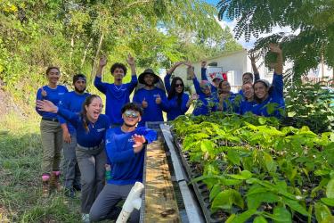
The workshops sought to improve coordination on marine spatial data between the federal government and its territorial partners and stakeholders in Puerto Rico and the U.S. Virgin Islands. These efforts provide foundational ecosystem-wide data generation that will help to support marine spatial planning in the region. This planning is vital to support the development of the blue economy, including industries like renewable energy and aquaculture.
The workshops had several key goals:
- Learn about NOAA's marine spatial planning approaches and activities
- Inventory available marine spatial data for the U.S. Virgin Islands and Puerto Rico
- Document data gaps and opportunities
- Increase local capacity and resources for regional ocean spatial planning
- Foster a community of stakeholders to inform future marine planning efforts

Key Workshop Takeaways
One key takeaway was the development of geospatial data layers for key ocean sectors. Other takeaways included identifying the need for:
- A central repository of publicly available data in the region
- Social science surveys to gather valuable information for future planning
- More data, and improved resolution of existing and future data
Participants expressed that these improvements would help our collective ability to inform decision making. They emphasized the importance of involving local stakeholders early and consistently to improve planning efforts, and a focus on equity and environmental justice in data collection and planning.
“These workshops were a huge step in promoting equity and collaboration in marine spatial planning,” said John Walter, Deputy Director for Science and Council Services at NOAA’s Southeast Fisheries Science Center. “By working together, we are promoting the use of sound scientific data to make decisions about sustainable development of ocean industries in the U.S. Caribbean.”
The discussions focused on six key ocean sectors:
- National security
- Industries
- Fisheries
- Natural resources
- Cultural and social resources
- Meteorology, oceanography, and other
Across many of these sectors, participants highlighted various data gaps and the need for enhanced, more accessible data. Some of the unique considerations raised included tourism, coral habitats, fishing, and social data. These critical pieces stemmed from the involvement of local stakeholders, who openly shared their knowledge and communities’ perspectives.
“Besides data collection, the workshops helped us form this strong community of stakeholders in the region.” said Jennifer Wright, regional spatial coordinator for NOAA’s National Centers for Coastal Ocean Science. “These collaborations are critical to ensure we are considering diverse perspectives when planning for the future of U.S. Caribbean waters.”

Next Steps for U.S. Caribbean Marine Spatial Planning
As a result of this workshop, NOAA will continue working with local stakeholders on science planning. We will develop a publicly available spatial planning database and toolbox for the region. This database will include all of the information sources from the workshops, as well as other data from local data leads. The outcomes and partnerships developed during these workshops are critical for preparing for future development of the blue economy throughout the United States Caribbean.
The events were led by the NOAA National Centers for Coastal Ocean Science Marine Spatial Ecology Division and NOAA Fisheries Southeast Fisheries Science Center. Workshop participants included:
- Local agency leaders
- Planners
- Environmental organizations
- Scientists
- Subject matter experts
- Caribbean Fishery Management Council
- Federal representatives from the Department of Defense and the Bureau of Ocean Energy Management