The new Southeast Inland Mapper is now available to those wanting to know if they need an essential fish habitat consultation. This new tool is designed to focus on the inland extent of EFH, complementing the current NOAA Fisheries offshore EFH Mapper.
Fish and other marine species depend on their habitat to survive and reproduce. Protecting and restoring essential fish habitat helps to maintain productive fisheries, rebuild depleted fish populations in the United States, and provide a buffer from storm impacts. Essential fish habitat is defined as those waters and substrate necessary to fish for spawning, breeding, feeding, or growth to maturity. Every year, our habitat experts advise agencies and the public on hundreds of projects, from port expansions to offshore energy development. These consultations ensure that coastal development projects do not harm these important habitats.
The Fishery Management Councils did not specify an inland boundary to the limit of EFH. There is often confusion as to whether or not an EFH consultation is required for a proposed project. The Inland Mapper is a publicly accessible tool to provide more clarity and improve efficiencies of EFH consultations during the permitting process. It maps the environmental characteristics that have been used to describe and identify EFH for federally managed species in the Gulf of Mexico and South Atlantic.
Data layers for federally managed fish species include:
- Habitat types
- Depths
- Salinities
- Tidal extents
Environmental data were obtained from sources that vary by region, e.g., state and federal agencies, commercial sources, and academic institutions.
How Does It Work?
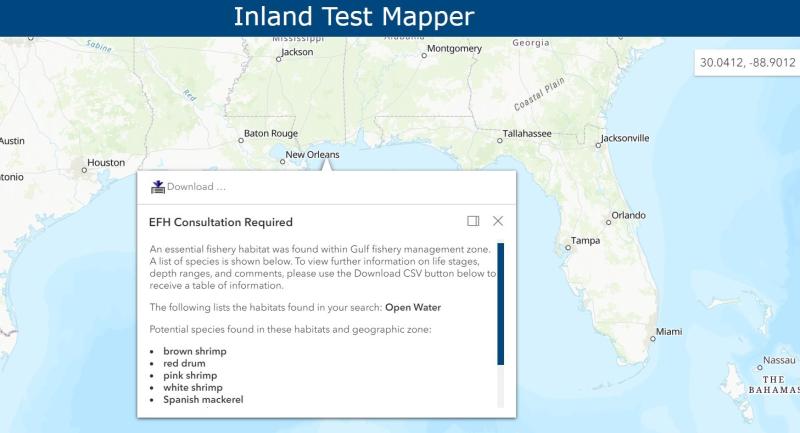
Say you might want to build a bridge. Go to the Inland Mapper and click on the location you intend to place the bridge (or enter the GPS coordinates for the site).
You will get one of three responses: “No EFH Consultation Necessary,” “EFH Consultation Required,” or “EFH Consultation Possible.”

If a consultation is required, the map will tell you the habitat and species in the area.

If a consultation is needed or possible, click on the “About” tab at the top right portion of the Mapper page. A box will appear providing more information.
Essential fish habitat consultations
Regional essential fish habitat coordinators

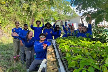
This pilot project was made possible through a partnership among the NOAA Fisheries Southeast Regional Office, Southeast Fisheries Science Center, the University of Miami Cooperative Institute for Marine and Atmospheric Studies, and the Living Marine Resources Cooperative Science Center at the University of Maryland Eastern Shore. University staff were vital in developing the underlying GIS layers and code that allows for people to search many areas quickly.
The goal with this pilot project was to continue to provide excellent customer service in the most efficient way, helping those taking the first step in the consultation process. Our hope is the tool will save the public time, direct them to the appropriate personnel once they determine their needs. In the future we hope it might be applicable to other areas across the country.
*The EFH Inland Mapper is a living tool. Content will be updated as new information becomes available.