The COVID-19 pandemic and typical fall weather conditions were challenges, but the Cooperative Gulf of Maine Bottom Longline Survey team and industry partners wrapped up a successful season in early November.
“Every single person on the bottom longline survey team worked incredibly hard to get the survey completed this fall,” said Anna Mercer, chief of the Cooperative Research Branch. “From building new software to installing new camera systems, from repeated COVID-19 testing to careful quarantining, from new work flows to new hardware, it was a true team effort.”
The survey targets groundfish at 45 stations across the Gulf of Maine using tub-trawl bottom longline gear. The survey plan focuses on rocky bottom habitat, where fish are difficult to sample with trawl gear.
New Data Collection System Used
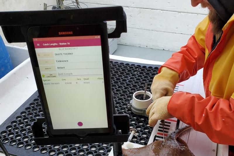
This year’s survey is the first to use a new data collection system developed by the branch. This next generation of software and hardware significantly upgrades digital data collection and catch processing at sea.
A tablet-based application replaces paper logs for most data types, improves operational efficiency, consistency, and data quality control for recording catch data and biological samples. Digital scales, electronic fish measuring boards, and barcode scanners now wirelessly communicate with the tablets. This keeps the system compact and agile for use on small commercial fishing vessels.
Both vessels were also newly equipped with electronic monitoring cameras. Adding cameras provides a way to get detailed information on the condition of bait or fish on hooks as the vessel retrieves the gear. This “hook status” information gives analysts a measure of hook availability—how available the hook is to fish that the gear encounters—which will improve understanding of catch rates.

What Happened on the Survey?
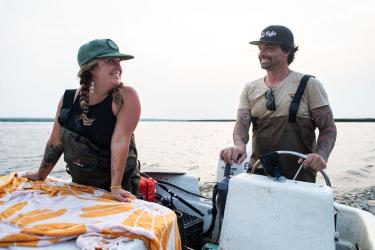
The two Massachusetts commercial fishing vessels chartered for the survey were the F/V Tenacious II out of Barnstable, and the F/V Mary Elizabeth out of Scituate. At each of the survey’s 45 stations, the vessels deployed longlines to soak for two hours during a slack tide. Each longline was 1 nautical mile in length, with 1,000 hooks baited with squid. When the vessel retrieved the gear, our scientists identified, weighed, measured, and sampled all of the catch.
Haddock, spiny dogfish, cusk, white hake, Atlantic cod, red hake, and thorny skates dominated catches this fall. Some larger cod were caught off Platts Bank (about 50 miles off Portland, Maine). Scattered catches of barndoor and thorny skates, pollock, and Acadian redfish were found at many of the nearby ridges and ledges.
Along with catch data, researchers collected videos of the substrate and environmental data, such as current velocity, temperature, and depth. Staff also collected sex and maturity data and structures for ageing for a number of important groundfish, skates, and other species. As in previous surveys, staff tagged thorny skates to support research conducted by collaborators at the New England Aquarium’s Anderson Cabot Center for Ocean Life.

Incorporating Cooperative Survey Data into Science and Management
Data collected by this survey will continue to provide information to improve and strengthen assessments for many species in the Gulf of Maine. This work supports stock assessments and fishery management for multiple federally managed species, including species not easily caught in other surveys, such as Atlantic wolffish. Stock assessment peer reviewers have recommended that scientists explore using a bottom-longline survey index in the wolffish stock assessment, and this will be further investigated.
For more information, contact Giovanni Gianesin.