Red King Crab Larval Advection

Initial spatial conditions for 1999, 2005, 2007, which are considered cold, warm, and intermediate years respectively. NOAA survey data are used to estimate larval density and spatial distribution at the time of hatch. Polygons are used to compare rates of connectivity and retention among regions.
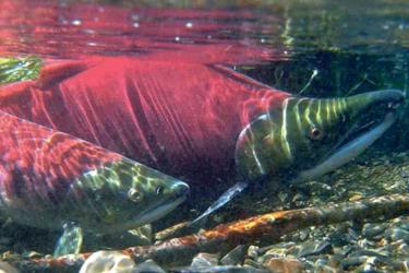
Red king crab larvae spend months in the water column and have specific habitat requirements upon settlement, which implies that the location of larval release relative to oceanographic processes and suitable juvenile habitat is important for determining recruitment success or failure in a given year.
Our ongoing study couples a biophysical individual-based model (IBM) and a Regional Ocean Modeling System (ROMS) circulation model to evaluate the importance of 1) climate and oceanographic conditions, and 2) female spatial distribution on larval advection trajectories.
Co-investigators refined an existing ROMS model by focusing on the Bristol Bay region, developed a finer scale (2 km) horizontal resolution grid that includes all circulation features and settlement areas relevant to red king crab larvae, and focus on representative years with contrasting bottom temperature conditions.
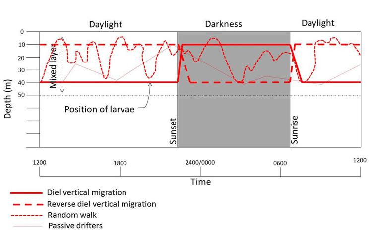
ROMS output, in the form of velocity, temperature, and salinity fields, drives the Lagrangian IBM, which tracks virtual larvae in space and time.
The IBM incorporates the most extensive biological information available for red king crab, including ovigerous female spatial distribution, fecundity, hatch timing, larval behavior, growth, and settlement habitat. A comprehensive analysis of invertebrate and sediment data suggests that optimal settlement habitats are primarily located inshore of the 50 m isobath.
Upcoming model simulations will address effects of model year, female spatial distribution, larval behavior, and hatch timing on large-scale advection.

Left: Model grid (2 km resolution) with sample surface velocities (weekly averages) for May 14, 1999. Every 5th vector is plotted. Right: Close-up of the model grid in Bristol Bay. All velocity vectors are plotted. Colors correspond to bathymetric depth in meters. Vector scale is shown in m s-1.

2013 and 2015 are examples of recent years with contrasting bottom temperature conditions. The cold pool (<2°C) is indicated by light blue. Red dots indicate mature female red king crab abundance based on NOAA survey data. The sizes of the dots correspond to relative abundance.

Locations where benthic habitat has been sampled historically. Red dots indicate locations classified a good habitat for settling red king crab post-larvae (i.e, provide structural complexity), while black dots indicate locations that do not contain good habitat for settling post-larvae (i.e., no structural complexity). These data will be used in the IBM to determine settlement success of virtual larvae. The map includes over 50,000 data points from a variety of sources covering the period of 1955-2012. The primary source of sediment data (gravel, shell, rock) is the EBSSed Version 2 database (R. McConnaughey, pers. comm.), with supplemental sediment data from NOS surveys by the NOAA ships Rainier and Fairweather in 1986, and NPRB Projects 1315 (I. Hartwell, NOAA Nat. Ctr. Coastal Ocean Sci.) and 201 (B. Bornhold, I. Harper). The sources of the biogenic epibenthos data are (1) an OCSEAP study of McMurray et al. (1984), (2) the 1976 studies of S. Jewett and H. Feder (Jewett and Feder 1981), and (3) notations of red king crab and epifaunal co-occurrence in the field logs of Bradley Stevens (NOAA, Kodiak) during the Ocean Hope 3 cruise in 1991.